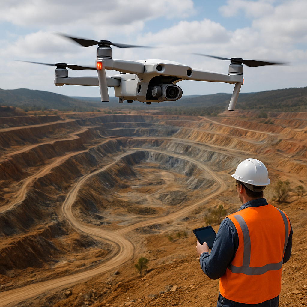
Unmanned aerial systems are transforming how companies locate and evaluate mineral resources. This article explores how modern exploration teams deploy drones equipped with advanced sensors to accelerate mineral mapping, improve decision-making, and reduce risk. It covers the principal technologies, the operational workflow from planning to interpretation, and real-world applications where airborne platforms deliver measurable value for greenfield and brownfield projects.
Technologies and data types used by exploration companies
The core advantage of aerial platforms lies in rapid, repeatable data collection across difficult terrain. Exploration firms typically select payloads that match their geological targets and budget. Commonly used payloads include multispectral and hyperspectral imagers, LiDAR scanners, magnetometers, and thermal cameras. Each instrument provides complementary information:
- Hyperspectral imagery captures fine spectral detail and can identify specific mineralogical signatures tied to alteration minerals such as iron oxides, clay minerals, and sulfates.
- LiDAR delivers high-resolution topographic models and structural mapping by producing dense point clouds, allowing geologists to visualize faulting and subtle geomorphic lineaments beneath vegetation.
- Lightweight magnetometers mounted on small platforms can detect variations in the magnetic field caused by mafic intrusions or iron-rich mineralization.
- Thermal sensors and multispectral cameras assist with surface temperature mapping and vegetation stress analysis, which may indirectly highlight mineral-related hydrothermal alteration.
Combining these datasets within a remote sensing framework creates a multi-dimensional picture of the subsurface expression of mineralization. Integration is often supported with ground control points and targeted sampling to calibrate and validate aerial anomalies.
Operational workflow: from planning to interpreted outputs
Successful aerial mapping programs follow a disciplined process that balances regulatory compliance, safety, and data quality. Typical steps include:
- Project scoping and reconnaissance: selecting target areas based on geological models, historic data, and accessibility.
- Flight planning: defining flight lines, altitude, sensor settings, and overlap requirements. Altitude and speed directly influence spatial resolution, signal-to-noise, and swath width.
- Regulatory approvals and risk assessment: coordinating with aviation authorities, securing airspace permissions, and establishing ground safety zones.
- Data acquisition: executing the mission under suitable weather conditions, with on-site monitoring of sensor health and positional accuracy using GNSS/RTK systems.
- Processing and quality control: performing radiometric correction, orthorectification, mosaicking, and point-cloud classification. Advanced workflows apply atmospheric correction and spectral calibration when working with hyperspectral data.
- Analysis and interpretation: applying geostatistical methods, spectral unmixing, machine learning classification, and integration with legacy exploration datasets (geochemistry, drilling, field mapping).
- Target generation and reporting: generating prospectivity maps, priority drill targets, and digital deliverables for stakeholders and permitting processes.
Automated pipelines and cloud-based processing platforms shorten turnaround times from days to hours, enabling faster decision cycles. Maintaining accuracy and traceability during each step is critical, especially when aerial data informs drilling decisions or resource estimates.
Data fusion and machine learning
Integration of multiple airborne datasets increases confidence in target identification. Common fusion strategies include stacking spectral indices, fusing LiDAR-derived morphometric variables with reflectance bands, and co-locating magnetic gradients with structural maps. Machine learning algorithms — supervised classifiers, anomaly detection, and deep learning models — are increasingly used to extract subtle patterns linked to alteration halos and lithological contacts. Training data often comes from a combination of field samples, historical assays, and high-confidence geologic maps.
Applications, benefits and operational considerations
Aerial platforms play distinct roles across the exploration lifecycle. Below are key applications and practical considerations that exploration companies weigh when deploying drone-based mineral mapping.
Primary applications
- Greenfield exploration: rapid coverage of large, remote areas to identify alteration signatures and structural corridors that warrant follow-up fieldwork.
- Detailed prospect evaluation: high-resolution surveys over known anomalies to refine drill collar placement and target orientation.
- Environmental baseline and monitoring: mapping vegetation health, hydrological features, and tailings stability for permitting and ESG reporting.
- Mine planning and geotechnical surveys: using LiDAR to generate accurate digital terrain models for pit design, slope stability analysis, and haul-road planning.
- Rehabilitation and brownfield assessment: mapping historical workings, waste dumps, and contamination footprints for remediation planning.
Benefits
- Speed and coverage: drones can survey tens to hundreds of square kilometers faster and more affordably than conventional airborne or ground campaigns.
- Improved safety: reduced need for field teams to access hazardous or inaccessible areas.
- Cost-effectiveness: lower operational costs for small to medium-sized surveys compared to manned aircraft, particularly for repeat monitoring.
- High spatial resolution: the ability to capture finer-scale features that are invisible in satellite imagery or coarse airborne surveys.
- Repeatability: regular overflights enable temporal change detection, which is valuable for monitoring alteration evolution or environmental impacts.
Limitations and challenges
- Regulatory constraints: airspace restrictions, line-of-sight requirements, and permitting can limit operational flexibility.
- Payload and endurance: small platforms may need multiple sorties or handoffs to cover large targets with heavy sensors.
- Data volume and processing demands: high-resolution and hyperspectral datasets require significant storage, compute power, and expertise to process correctly.
- Vegetation cover and weather: dense canopy or prolonged cloud cover can reduce the effectiveness of optical sensors, whereas LiDAR and magnetics retain utility.
- Calibration and validation: spectral libraries and ground truth samples are essential to link remote signatures to actual mineralogy; without them, false positives may mislead exploration programs.
Case examples and industry adoption
Exploration companies across commodities — gold, copper, lithium, and rare earth elements — are integrating aerial workflows to accelerate discovery and de-risk projects. Representative examples include:
- Using hyperspectral surveys to delineate potassic and phyllic alteration zones above concealed porphyry copper systems; airborne spectral anomalies guide focused geochemistry and drilling.
- Deploying magnetometer-equipped drones to map shallowly buried mafic-hosted nickel-copper sulfide bodies in terrains with limited outcrop.
- Combining remote sensing datasets with field spectroscopy to map clay alteration associated with lithium-bearing pegmatites, prioritizing targets for trenching.
- Applying recurrent LiDAR surveys to quantify landscape change and tailings dam deformation as part of environmental stewardship programs.
Many junior explorers allocate a fraction of early-stage budgets to UAV surveys to produce high-resolution reconnaissance maps that would otherwise cost an order of magnitude more using traditional airborne campaigns. Larger companies are using drones as tactical tools to augment manned aircraft surveys, providing targeted infill data at higher spatial resolution.
Operational best practices
To maximize the value from aerial mineral mapping, practitioners commonly adopt these best practices:
- Define clear exploration objectives and select sensors that match mineralogical indicators of interest.
- Invest in adequate ground truthing and sample collection to build robust spectral libraries and classifier training sets.
- Plan flights with redundancy in mind: overlapping passes and repeated coverage help mitigate data gaps caused by intermittent weather or sensor dropouts.
- Use differential GNSS or RTK for precise georeferencing when positional accuracy is critical for drill targeting.
- Create standardized data pipelines and metadata records to ensure reproducibility and traceability across phases of exploration.
Future trends and technological convergence
The pace of innovation in unmanned platforms and sensing technologies suggests several trends likely to shape exploration practice. Battery and propulsion advances will extend flight endurance, allowing larger surveys with fewer interruptions. Sensor miniaturization will bring more capable instruments within the weight limits of small UAVs, widening the range of detectable signatures. Cloud-native processing solutions and edge-compute capabilities will compress the time from acquisition to actionable insights. Increasing use of artificial intelligence will help detect subtle, non-linear relationships within multi-sensor datasets, enabling the identification of hidden or emergent exploration targets.
As regulatory frameworks evolve and industry standards for data quality mature, remote aerial surveys are expected to become a routine component of exploration toolkits. Companies that harmonize field geology, geochemistry, airborne sensing, and advanced analytics will be better positioned to convert early-stage anomalies into drill-ready targets with measurable impact on discovery success rates.
